Introduction
In the ever-evolving landscape of property insurance, geospatial tools have emerged as indispensable assets, reshaping the way insurers approach their business. By leveraging Geographic Information System (GIS) technology, these tools play a pivotal role in risk assessment, underwriting, and claims management processes, bringing about efficiency and accuracy like never before. Insurers can unlock these capabilities by utilizing their exposure data, Snowflake, and advanced Tableau capabilities. In this blog, we’ll demonstrate how Kipi can help implement analytics tools to address three property insurance use cases.
Understanding Exposure Concentrations
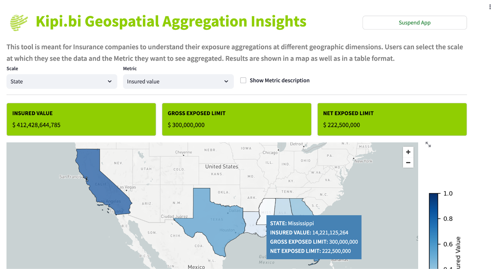
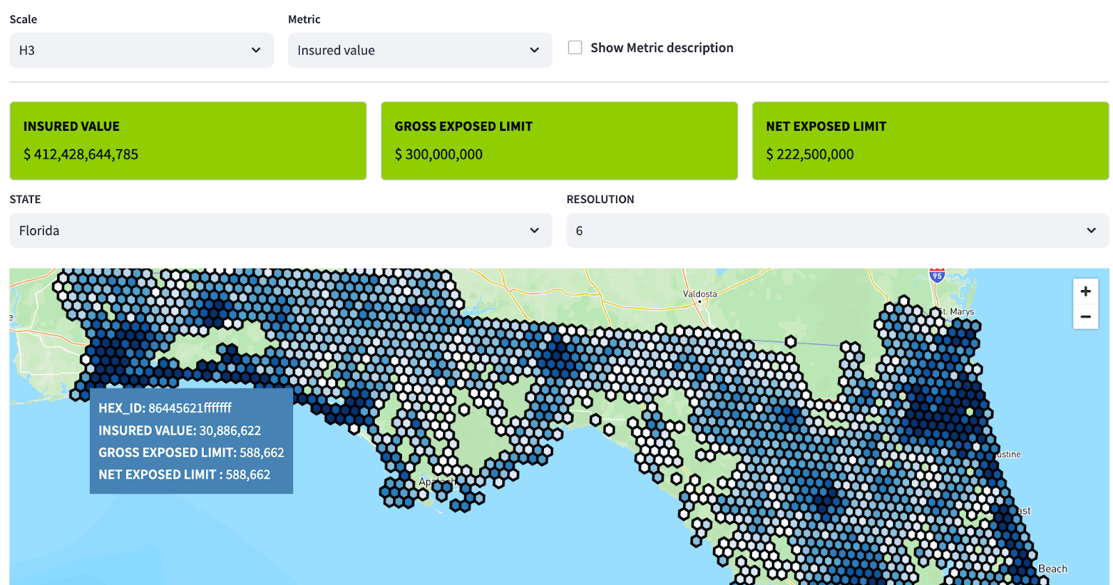
Geospatial tools enable insurers to identify and analyze exposure concentrations in specific geographic areas. By overlaying property data with information on natural hazards, crime rates, and other relevant factors, insurers can pinpoint regions with high concentrations of insured assets. This knowledge is critical for assessing the potential impact of a catastrophe event on a portfolio and ensuring sufficient reinsurance coverage for such high-risk areas. It’s incredibly important to understand aggregations of business at different geographic regions as well such as county and state or at different H3 levels. Additionally, understanding exposure concentrations helps insurers proactively manage risk by implementing loss prevention measures and targeted risk mitigation strategies. Check out some of the features available inside our Geospatial Aggregation Tool:
Catastrophe Risk Characteristics
Geospatial tools play a pivotal role in assessing catastrophe risk characteristics at a granular level. Insurers can use these tools to evaluate a property’s susceptibility to various natural perils, such as hurricanes, earthquakes, wildfires, and floods, based on historical data and hazard mapping. By integrating this information into their underwriting processes, insurers can tailor coverage and pricing to accurately reflect the unique risk profile of each property. This enhances risk selection and pricing accuracy, reducing the potential for underestimating or overestimating the exposure to catastrophe risks. Integrating third party data sources such as FEMA National Risk Index, specifically built to inform insurance industries on catastrophic risk, one can view the susceptibility of the current book and new business to various catastrophic risk elements. You can access the FEMA NRI today for free on our Snowflake Marketplace listing!

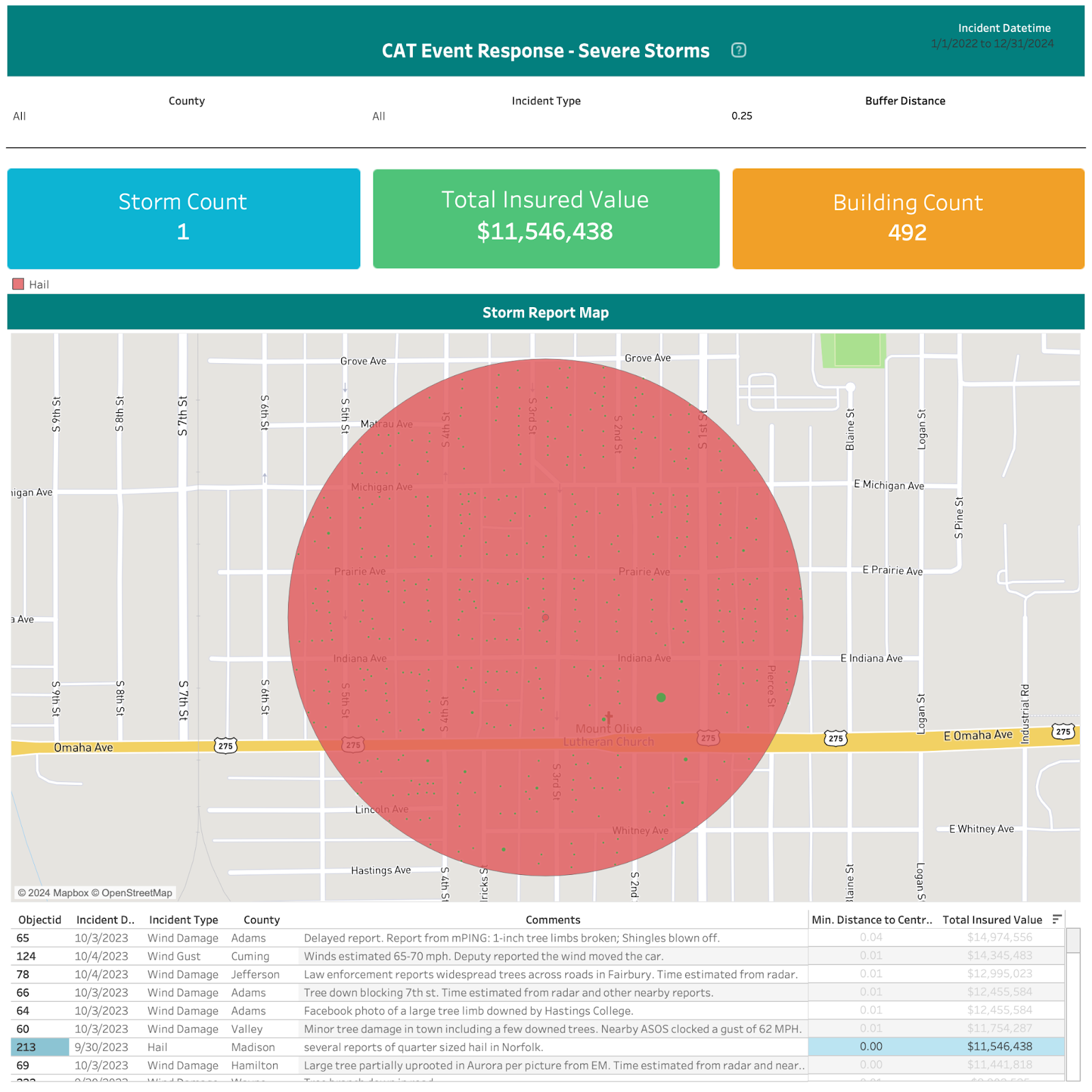
Understanding Exposure to Recent Catastrophe Events
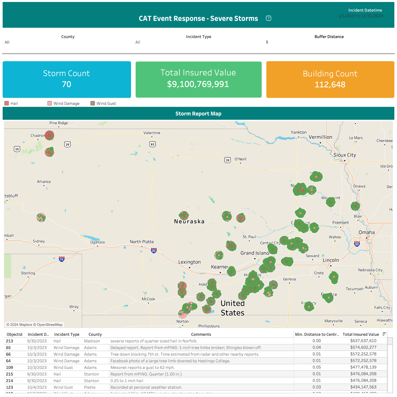
After a catastrophic event, geospatial tools become instrumental in understanding the extent of the damage and exposure of insured assets. By analyzing real-time geospatial data, insurers can quickly assess the affected areas and prioritize claims processing accordingly. This expedites the claims settlement process, allowing insurers to respond promptly to policyholders’ needs during challenging times. Moreover, such insights aid in assessing the overall impact of the event on the insurer’s portfolio and informing future risk management strategies. By integrating FEMA’s Geospatial Resource Center, we can quickly pinpoint the location of hail, tornado, wildfire, flood, and hurricane events compared to insured’s assets. Check out the capabilities here:
Geospatial tools have proven to be indispensable for property insurance companies, enabling them to delve deeper into risk exposure, catastrophe characteristics, and event impacts. By harnessing the power of GIS technology, insurers can make data-driven decisions, optimize underwriting processes, and efficiently manage claims. The use cases of geospatial tools, such as understanding exposure concentrations, assessing catastrophe risk characteristics, and evaluating the impact of recent catastrophic events, empower insurers to proactively manage risks, enhance customer service, and solidify their position in the competitive insurance market. Embracing geospatial technology is not just an advantage but a necessity for property insurance companies seeking to thrive in an ever-evolving industry landscape.
Why partner with Kipi for these tools?
Kipi brings specialized knowledge in data analysis, tool customization, and industry best practices, enabling quick implementation and value add. Engaging Kipi ensures expert guidance through the complex process of integrating GIS technology, including ingesting, storing, and optimizing in Snowflake.